

FREDERICK COUNTY DISTRICTS AND VOTING PRECINCTS
Frederick County uses districts and precincts to organize local representation and elections. Your residential address determines your magisterial district, voting precinct, polling place, and state and federal legislative districts.
SIX MAGISTERIAL DISTRICTS
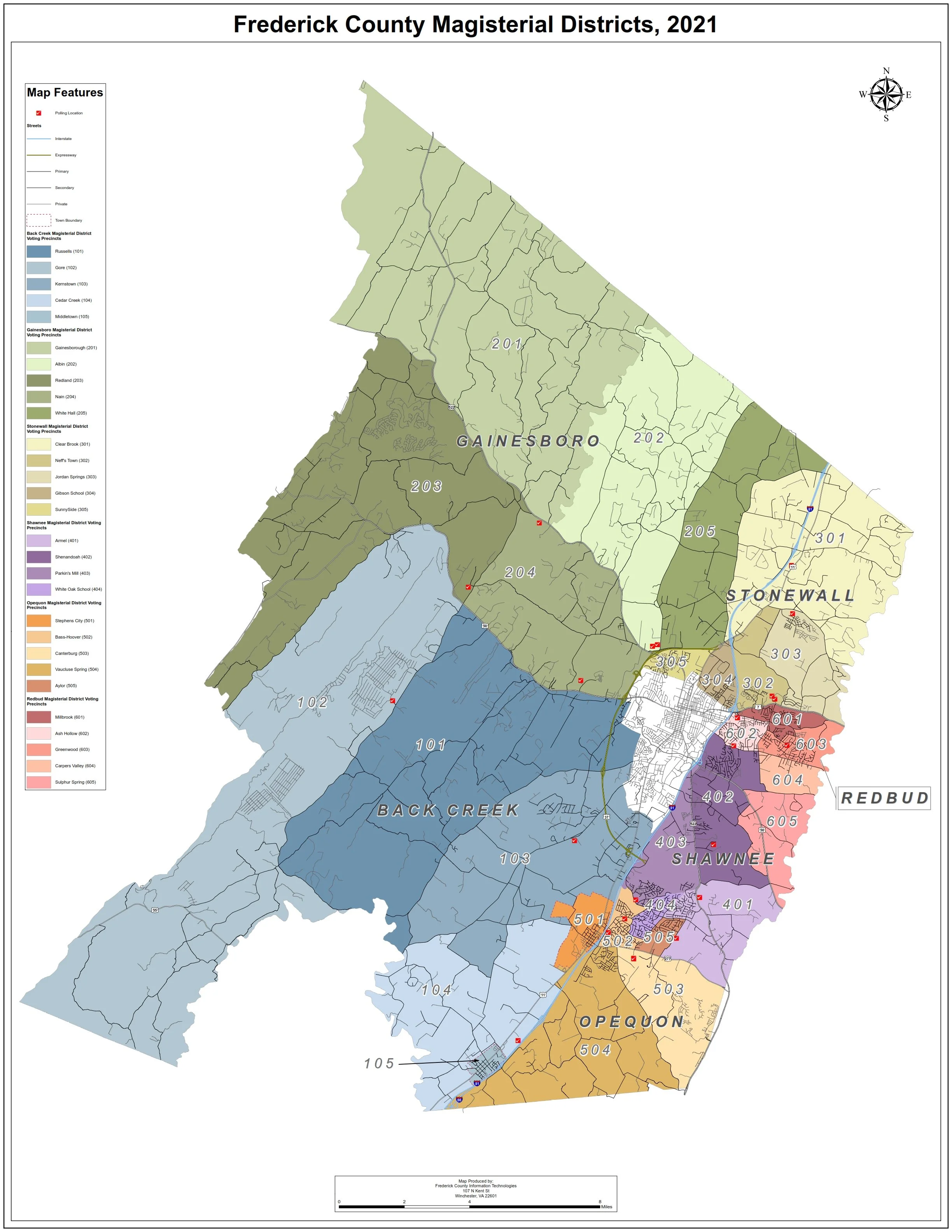
Frederick County’s six magisterial districts are: Back Creek, Gainesboro, Opequon, Red Bud, Shawnee, and Stonewall. District boundaries should always be confirmed through official county or state tools because redistricting and address assignments can change.
VOTING PRECINCTS AND POLLING PLACES
Frederick County currently lists 29 polling places. A familiar nearby school, church, or community building is not necessarily your assigned polling place. Confirm the location tied to your registration before Election Day.
CONFIRM YOUR ADDRESS-SPECIFIC INFORMATION
Use Virginia’s official voter portal to check your registration, precinct, polling place, and absentee-ballot information:
https://vote.elections.virginia.gov/VoterInformation
OFFICIAL FREDERICK COUNTY POLLING INFORMATION
Frederick County’s Office of Elections publishes county polling-place information and election notices:
https://www.fcva.us/departments/office-of-elections-voter-registration/polling-place-information
WHY DISTRICTS MATTER
Different addresses within Frederick County may vote for different members of the Board of Supervisors, Virginia Senate, or House of Delegates. Candidate and sample-ballot information should therefore identify the district or locality it applies to.
IF YOUR INFORMATION DOES NOT MATCH
Contact the Frederick County Office of Elections rather than relying on an unofficial map or old campaign material. Official election administrators can resolve registration, address, precinct, and polling-place questions.
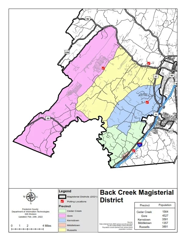
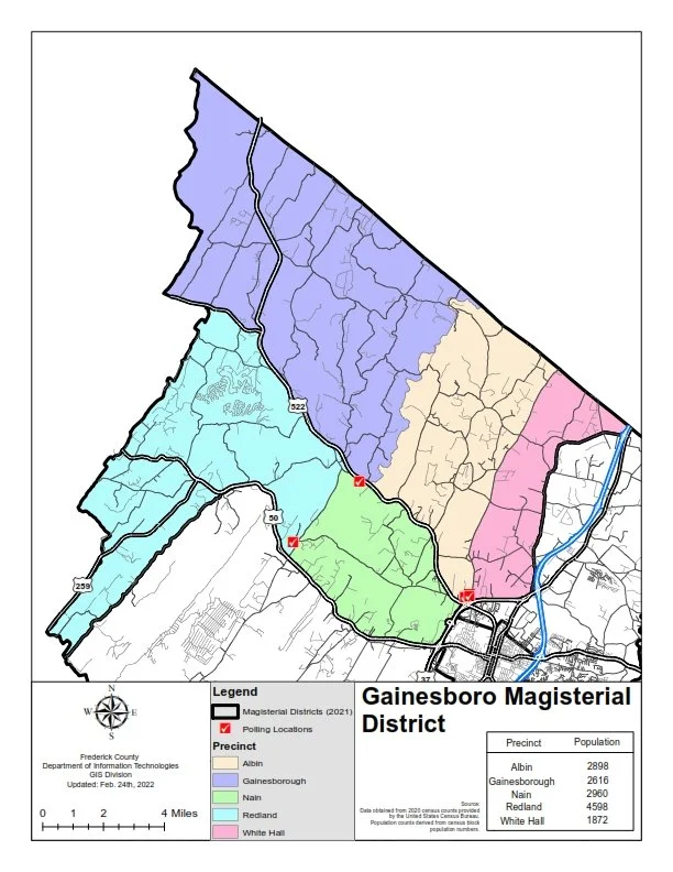
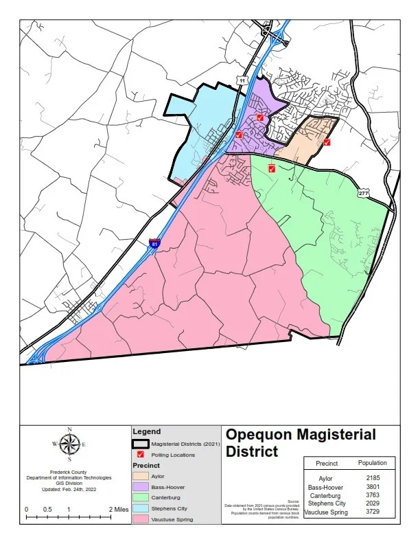
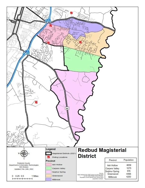
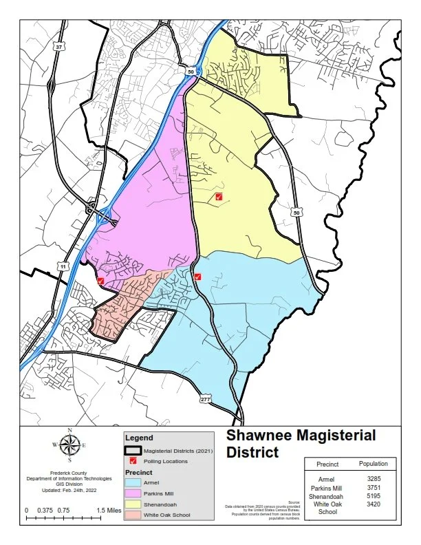
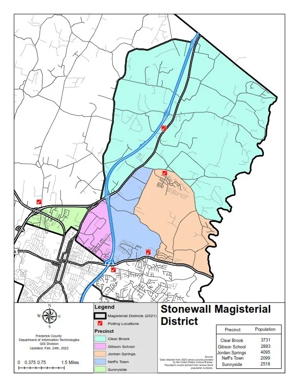
CHECK MAPS BELOW
The following maps can help you identify which district you reside in!
Last reviewed September 22, 2026.